Search This Website

Showing posts with label FAMOUS PLACES. Show all posts

Saturday, 24 September 2016

Kuari pass trek uttarakhand Himalayas Adventure Tour Femous Place of India


                            Kuari Pass Trek


                  Image result for kuari pass uttarakhand


Well, if you are thinking to taste something more than heritage buildings, temples, or wildlife, plan to embark on Kuari Pass Trek. One of the most popular trekking trails in Garhwal Himalaya, this moderate trek reaches at a height of around 4268m and takes around 3-5 days to complete. The jaw-dropping vistas of snow-clad Nanda Devi, Chaukhamba, Kamet, Dronagiri are seen from this trail. The trek passes through lush green valleys, small villages and thick forests covered with snow.

Ghat is a small friendly settlement in the Nandakini Valley and located about 19 km from Nandprayag.  From Ghat, the route goes via Ramni, Sarkot, Jhenjipatni, Pana, Irani, Sanatoli, and Domabhiti to the Kuari Pass.


                   Image result for kuari pass trek

The Ramni-Kuari Road is also known as Curzon Road, because Lord Curzon, a keen trekking enthusiast, trekked from Gwaldom to Ramni and on to Kuari pass, when he was the Viceroy of the British India.

The trek passes through the picturesque areas around Ramni, then trails along to Sarkot and Sanatoli where from expansive view of the Himalayas can be had.  At times, the going can really be strenuous, especially in the sections Ghat to Ramni and Domabhiti to Kuari.

The road till Nandaprayag is the part of national highway to Badrinath and  192 km from Rishikesh. It takes around 6-7 hours to reach Nandaprayag from Rishikesh and another 30 – 40 minutes to reach Ghat at a moderate speed. 


                      Image result for girls kuari pass trek

Kuari Pass Trek - A short 5 day trek into the Nanda Devi Santuary The Kuari Pass trek which gives you spectacular views of the Nanda Devi sactuary and a host of 7000m snow-capped peaks that extend into Tibet.

"We breasted the slope and halted, silent on the path. No words would express our delight. The Himalayas were arrayed before us in a stupendous arc" - Frank Smythe (The Mountaineer)

Kuari which means "doorway" is a Himalayan high mountain pass situated in the Garhwal region of northern India, south of the Tibetan border and on the western rim of the "Nanda Devi Sanctuary" Biosphere Reserve and falls in the Chamoli district. The Kuari Pass Trek found fame in the early 1900's when intrepid adventurers and mountaineers such as Lord Curzon, Eric Shipton and Bill Tilman used the passage in their pioneering explorations of the region.The Kuari Pass trek is known as The Curzon Trail (named after the former British Viceroy Of India "Lord Curzon").

                     Image result for girls kuari pass trek   

Winter Kuari pass trek is famous for its views. The views on the winter Kuari Pass trek are often cited as the best in the Indian Himalayas. It is not hard to discover why. To the north of the Kuari Pass is the Chaukhamba Range, while the summits of Mana (7272m), Kamet (7756m) and Abl Gamin (7355m) extend to the Tibet border.In the middle foreground, a number of spectacular peaks including Dunagiri (7066m) and Changabang (6864m) enclose the Nanda Devi Sanctuary while to the west the snowcapped ranges extend to Gangotri.

It will be enjoyable to combine the second and fourth treks, that is going from Joshimath to Auli, Gorson, Chitrakantha, Kuari pass and returning via Khulara, Tapoban. In this way, the trekkers will have an opportunity of visiting the beautiful bugyals of Auli and Gorson, and have the benefit of a rejuvenating bath in the hot water springs of Tapoban before returning to Joshimath. The options of trekking routes shall be intimated before the departure so a proper arrangement could be made in advance.


How to Reach: To join this trek one needs to reach Haridwar. Haridwar to Joshimath by taxi and then trekking starts from here. Haridwar has its own railway station.


Read More »

Tuesday, 20 September 2016

Matheran There are lots of lookout points that provide spectacular views of the surrounding hills and valleys. Matheran has a reasonably dense forest cover.


                                                  Matheran

                      Image result for amazing  matheran

The smallest hill station in India, Matheran which is only 90 km from Mumbai, provides a pretty dramatic view of the sunset and the sunrise.

Matheran is a most famous and coolest Hill Station situated in Karjat Tahsil, Raigad District of Maharashtra, India. Matheran is the smallest hill station of India. It is located on the range of Western Ghats at height of 800 m (2625 Feet) above sea level. The name Matheran means either ‘Forest on Top’ or ‘Woodland overhead’. 

Matheran is located around 90 km from Mumbai, 120 km from Pune and about 320 km from Surat. 


Matheran is awesome place for to spend weekend.     

                      Image result for amazing  matheran

Matheran is a hill station and a municipal council in the Raigad district in the Indian state of Maharashtra. It is a hill station in Karjat Tahsil and is also the smallest hill station in India. It is located on the Western Ghats range at an elevation of around 800 m (2,625 feet) above sea level. It is located around 90 km from Mumbai, and 120 km from Pune. Matheran's proximity to many metropolitan cities makes it a popular weekend getaway for urban residents. Matheran, which means "forest on the forehead" (of the mountains) is an eco-sensitive region, declared by the Ministry of Environment and Forest, Government of India. It is Asia's only automobile-free hill station.

Matheran as a Hill Station was discovered by a British, Mr. Huge Mallet, the then Collector of Thane, in 1850.

Matheran is an eco-sensitive region, declared by the Ministry of Environment and Forest, Government of India. It is one of the few places in the world where vehicles are not allowed, which makes the place different from others. Matheran takes you over a hundred years back in time when there were no vehicles. Because of vehicles being banned in Matheran, the place is quite peaceful despite the thousands of lakhs coming to visit throughout the year.


                       Image result for about matheran


There are lots of lookout points that provide spectacular views of the surrounding hills and valleys. Matheran has a reasonably dense forest cover.


There are around 38 designated look-out points in Matheran, including the Panorma Point that provides a 360 degree view of the surrounding area and also the Neral town. From this point, the view of sunset and sunrise is breathtaking. The Louisa Point offers crystal clear view of the Prabal Fort. The other points are the One Tree Hill Point, Hart Point, Monkey Point, Porcupine Point, Rambgh Point, and more.


There are around 38 designated look-out points in Matheran, including the Panorama Point that provides a 360 degree view of the surrounding area and also the Neral town. From this point, the view of sunset and sunrise is dramatic. The Louisa Point offers crystal clear view of the Prabal Fort. The other points are the One Tree Hill Point, Heart Point, Monkey Point, Porcupine Point, Rambagh Point, and more. To stay there, there are plenty of hotels.There are a lot of Parsi bungalows. Beautiful old British-style architecture is preserved in Matheran. The roads are not metalled and are made of red laterite earth. There are many "points" (viewpoints) in Matheran which give a panoramic view of the plains below.


                     Image result for amazing  matheran

History

Matheran was identified by Hugh Poyntz Malet, the then district collector of Thane district in May 1850. Lord Elphinstone, the then Governor of Bombay laid the foundations of the development as a future hill station. The British developed Matheran as a popular resort to beat the summer heat in the region. Matheran is birthplace of famous freedom fighter Veer Bhai Kotwal. He was born on 1 December 1912 in a barber family. State Govt. has built a monument in his memory. The Matheran Hill Railway was built in 1907 by Sir Adamjee Peerbhoy and covers a distance of 20 km (12 mi), over large swathes of forest territory. The Matheran hill railway, also known as Matheran Light Railway (MLR), was inspected by UNESCO world heritage site officials but failed to make it to the list as a World Heritage Site. India's other Hill Railways like the Darjeeling Railway, the Kangra Valley Railway, Nilgiri Mountain Railway are already on the list.


                    Image result for amazing  matheran


Forest and wildlife

Matheran has been declared an ecosensitive region by the Union Environment Ministry and can be called a Health Sanatorium in itself. A good collection of the dried plants is deposited in Blatter Herbarium, St. Xavier's College, Bombay, Mumbai. The only form of automobile allowed in Matheran is an ambulance operated by the Municipality. No private automobiles are allowed. Within Matheran transport facilities available are horses and hand-pulled rickshaws. Matheran has a huge number of medicinal plants and herbs. The town also has a large monkey population, including bonnet macaques and Hanuman langurs. The nearby Lake Charlotte is the main source of Matheran's drinking water. Inside the forest animals like leopard, barking deer, Malabar giant squirrel, fox, wild boar, mongoose are found.

                   Image result for about matheran

There are altogether 28 points, 2 lakes, 2 parks, 4 major worship places and a racecourse to visit inside Matheran. It takes about 2–3 days on your feet for a complete adventure. Important points are Alexander Pt., Rambag Pt, Little Chowk Pt, Big Chowk Pt, One Tree Hill Pt, Belvedere Pt, Olympia Race Course, Lords Pt, Charlotte Lake, Pisharnath Mahadev Mandir, Celia Pt (a water fall mouth), Echo Pt., Porcupine Pt (Sun Set Pt), Panorama Point (Sun Rise Pt), Khandala Pt, Madhavji Garden & Point, Matheran Railway Station, Louisa Point, Mayra Point, Pisarnath Temple, Matheran Shiv Mandir.View points like monkey and echo, steep cliffs, deep ravines; and squirrel & There are many picnic spots.


Read More »

Saturday, 27 August 2016

Beautiful Nainital A perfect honeymoon spot in the Himalayan bounty, Nainital has a picture of forested valleys amidst which gently sails a lake.


                                     Beautiful Nainital

                       Image result for nainital best place \


A perfect honeymoon spot in the Himalayan bounty, Nainital has a picture of forested valleys amidst which gently sails a lake. Looking at the huge influx of tourists from domestic as well as international lands, numerous hotel constructions have made their way on the banks.

From the windows the sight of the beautiful lake and the surrounding Himalayas rising above the green forests says about the beauty of Nainital on its own. In order to admire this beauty of the region, mark the summer months as your holiday time. Summer temperature stays moderate with a cool breeze to make the evening sightseeing plans really wonderful.


                Image result for Beautiful nainital sunset\

Nainital pronunciation is a popular hill station in the Indian state of Uttarakhand and headquarters of Nainital district in the Kumaon foothills of the outer Himalayas. Situated at an altitude of 2,084 metres (6,837 ft) above sea level, Nainital is set in a valley containing a pear-shaped lake, approximately two miles in circumference, and surrounded by mountains, of which the highest are Naina (2,615 m (8,579 ft)) on the north, Deopatha (2,438 m (7,999 ft)) on the west, and Ayarpatha (2,278 m (7,474 ft)) on the south. From the tops of the higher peaks, "magnificent views can be obtained of the vast plain to the south, or of the mass of tangled ridges lying north, bounded by the great snowy range which forms the central axis of the Himalayas."

Nainital has temperate summers, maximum temperature 27 °C (81 °F); minimum temperature 7 °C (45 °F), during which its population increases more than fivefold with an annual influx of tourists predominantly from the plains of northern India. In winter, Nainital receives snowfall between December and February with the temperatures varying between a maximum of 15 °C (59 °F) and a minimum of −3 °C (27 °F).
Its climate is classified as subtropical highland (Cwb) according to Köppen-Geiger system.

                Image result for nainital best place \  

Nainital Lake

Known commonly as the Naini Lake, it is situated in the middle of the town and is the lifeline of Nainital. Boating facilities are available for the visitors and alternatively a slow paced stroll around the lake will offer a serene relaxation like no other.

It is believed that the Naini Lake is one of the 64 Shakti Peeths, or religious sites where parts of the charred body of Sati (Parvati) fell on earth while being carried by Lord Shiva. The spot where Sati's eyes (or Nain) fell, came to be called Nain-tal or lake of the eye. The goddess Shakti is worshiped at the Naina Devi Temple on the north shore of the present day lake.

                    Image result for girls in naina park nainital

Naina Peak

Known as the Cheena or China Peak by the locals, Naina Peak is the highest peak in Nainital. It is situated at an average elevation of 2,615 meters above sea level and is a popular trekking spot in Nainital. The spot is known to offer one of the most amazing panoramic views of the entire valley and Nainital situated near the Naini Lake.

Tiffin Top


Located at the Aryapatta Hill at an average elevation of 2292 meters above sea level, Tiffin Top is a famous view point that offers some of the most breathtaking views of the Himalayas and Nainital. The place is named after an English painter Dorothy Kellet who used to sit at this very spot and paint. This place is also known as Dorothy’s seat.

St. John In The Wilderness

St. John in the Wilderness refers to a church which was established in 1844 and is located on the north end of the town. The church was named so after the Bishop of Calcutta was obliged to sleep in an unfinished house in the wilderness after falling ill. The church is located in a hidden and serene located amidst the deodar forests and is built in a Neo- Gothic styled architecture with stained glass windows from Belgium.
                   Image result for Beautiful nainital

Pt. G.B. Pant High Altitude Zoo


Located at an average elevation of 2,100 meters above sea level, Pt. G.B. Pant High Altitude Zoo was established in 1984 and was opened to general public in 1995. The zoo contains several exotic and endangered species of animals and birds which are native to this region. Snow Leopard, Himalayan Bear, Tibetan wolf etc. are few of the endangered species found here.

Gurney House


Gurney House refers to a cottage which is famous for being the residence of the British conservationist Jim Corbett. The house was built in 1881 and is located near the Nainital Lake. The materials used in the building were reused components of an older house which was present at this site. The house was sold to Mr. Sharda Prasad Varma in 1947 when the Corbett family left for Kenya.


                Image result for Beautiful nainital

Eco Cave Gardens

Eco Cave Gardens are an interconnected network of caves and attract huge crowds of tourists and are a treat for kids upon their visit. The park comprises of seven caves which are reached through a narrow and winding road with amazing views during the commute. This is one of the best places one should visit with the family and is of special interest to kids with the musical fountain that is located here.

Snow View

One of the best viewpoints in Nainital, the Snow View is located at an average elevation of 2,270 above sea level is reachable by a cable car. It provides amazing and picturesque views of the snow capped Himalayas with the major peaks like Nanda Devi, Nanda Kot and Trishul. The stay is chargeable for each hour that you spend at the spot and can be visited between 10 am to 5 pm.
              Image result for Beautiful nainital Lands End
Lands’ End
Famous for being a spot that is usually reached by trekkers, Land’s End is a picturesque location and the amazing views from this spot are like none other. The spot is located at an average elevation of 2,118 kilometers above sea level provides views of the surrounding hills and is surrounded by some beautiful trees and pine forests.

Kilbury Bird Sanctuary


One of the few high altitude bird sanctuaries in India, the Kilbury Bird Sanctuary is located at an average elevation of 2000 meters above sea level. The sanctuary is a home to over 240 different species of Birds which are both migratory and resident. The sanctuary is located at a picturesque forest village called Pangot.
While there are various other attractions like Pangot and Sonanadi Wildlife Sanctuary, the above mentioned 10 tourist places in Nainital are the most popular destinations and are a must-visit to derive the best experience from your visit.


Read More »

Saturday, 20 August 2016

Its Not Water Its Cloud, Skandagiri Hills Above the clouds Famous Place of India


                 Skandagiri Hills


Skandagiri, also known as Kalavara Durga, is a mountain fortress located approximately 62 km from Bangalore city, and 3 km from Chikballapur in the Indian state of Karnataka. It is off Bellary Road (National Highway 7 Hyderabad-Bangalore Highway), and overlooks Nandi Hills and Muddenahalli. The peak is at an altitude of about 1350 meters. It is accessed from Kalavara village, which has population of 1093 according to 2011 census.
This tourist spot has been closed by the forest department when checked on May 21, 2016, They claimed someone was murdered in the hills and that is the reason its closed for public.


Also known as Kalavara Durga, Skandagiri is a mountain fortress located just 70 kms from the city of Bangalore. Although much hasn't been written about the place, the gorgeous photographs suggest that it's a perfect weekend trip for people living in Karnataka. Off Bellary Road (National Highway 7 Hyderabad-Bangalore Highway), and overlooking Nandi Hills and Muddenahalli, this place guarantees a breathtaking view at an altitude of about 1350 mts.


Much adored for the view of a beautiful sunrise and beds of clouds, the picturesque Skandagiri Hills - the lesser-known cousin of Nandi Hills - has all the right ingredients to attract trekkers. 
Also, the tempting reviews on different online platforms too present a rosy picture. 

However, most of the trekkers remain ignorant of the fact that trekking remains completely banned in the day or night and hundreds of clueless trekkers return home having missed the thrill of trekking.


Determined to watch the sunrise, Dhananjay Gowda from Ulsoor, along with his colleagues, recently took a taxi to reach the foothills of Skandagiri, which is in Chikkaballapur, about 70 km from the City. 

However, things did not transpire according to their plan. They were told by the security personnel about the ban, he said.

“We chose to trek after going through the online reviews on TripAdvisor, which presented a beautiful picture of the top view. We reached the spot at midnight but the security personnel were strict. Like us, there were many of trekkers who came in the night between 12.30 and 3.00 am, but none were allowed to trek,” he said and added that all of them were keen to enjoy the sunrise.  


Illegal route
Quoting the guards on duty, he said, “Even if someone takes an illegal route to go up escaping the sight of the security personnel, the trekkers will be confronted by the villagers in the morning while walking down the hill.” 

Virander Sirohi of the Bangalore Trekking Club (BTC) said trekkers most often rely on online  reviews and sometimes are misguided. “Although, day trekking was allowed at Skandagiri a few months ago, the Forest department banned trekking completely due to some anti-social incidents. For this, we have to blame our behaviour. Some trekkers litter the hills and a few smoke (which can lead to wildfires), while others consume alcohol on the top of the hill,” he said. Syed Nizamuddin, Range Forest Officer (RFO) of Chikkaballapur, said that Skandagiri comes under the reserved forest area and any trespassing could lead to imprisonment for up to three months. 


“About 500 to 1,000 trekkers come here on the weekends and in the holidays, but we do not allow any of them to trek up. Even the villagers are very particular about it,” he said.

Dr V R Naik, Deputy Conservator of Forests, said there is a proposal to let day trekking resume due to the high demand by trekkers and tourists. “We are working on the proposal in terms of holding a full-fledged nature camp with a guide for every batch. But, we can not surpass the Forest Act,” he added. 

Read More »

Wednesday, 20 July 2016

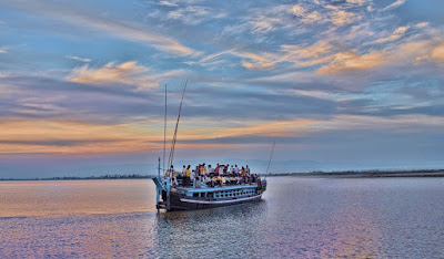
The island is formed by the Brahmaputra river in the south and the Kherkutia Xuti. Majuli is a beautiful and unexplored place resplendent with several festivals throughout the year.


                                     Majuli, Assam


Famous as the “World’s largest fresh water island”, this idyllic river island on the River Brahmaputra is located 20 kilometers away from the city of Jorhat. Referred to as the cultural capital of Assam, Majuli is a beautiful and unexplored  place resplendent with several festivals throughout the year. A must visit offbeat place t travel.
Ideal season to visit Majuli: Majuli is probably most beautiful during the monsoon, when the river is swollen and beautiful. October-March is a nice time to visit, with the cool climate makes a trip to Majuli absolutely worthwhile.


Mājuli or Majoli is a large river island in the Brahmaputra River, Assam, India. The island had a total area of 1,250 square kilometres (483 sq mi), but having lost significantly to erosion it had an area of only 352 square kilometres (136 sq mi) in 2014. Majuli has shrunk as the river surrounding it has grown.
The island is formed by the Brahmaputra river in the south and the Kherkutia Xuti, an anabranch of the Brahmaputra, joined by the Subansiri River in the north. Mājuli island is accessible by ferries from the city of Jorhat. The island is about 200 kim east from the state's largest city —Guwahati. It was formed due to course changes by the river Brahmaputra and its tributaries, mainly the Lohit. Mājuli is the abode of the Assamese neo-Vaisnavite culture.

Originally, the island was a long, narrow piece of land called Majoli (land in the middle of two parallel rivers) that had the Brahmaputra flowing in the north and the Burhidihing flowing in the south, till they met at Lakhu. Frequent earthquakes in the period 1661–1696 set the stage for a catastrophic flood in 1750 that continued for 15 days, which is mentioned in historical texts and reflected in folklore. As a result of this flood, the Brahmaputra split into two branches — one flowing along the original channel and the other flowing along the Burhidihing channel and the Mājuli island was formed. The Burhidihing's point of confluence moved 190 km east and the southern channel which was the Burhidihing became the Burhi Xuti. The northern channel, which was previously the Brahmaputra, became the Luit Xuti. In due course, the flow in the Luit Xuti decreased, and it came to be known as the Kherkutia Xuti; and the Burhi Xuti expanded via erosion to become the main Brahmaputra River.

The locals speak in the Mising and Assamese languages.
Reference regarding the early existence of Majuli is found in Yogini Trantathat Sutiya king Ratnadhajpal founded his capital in Ratanpur, Majuli which was perhaps washed away by the Brahmaputra.
Mājuli has been the cultural capital of Assamese civilisation since the 16th century; based on written records describing the visit of Srimanta Sankardeva — a 16th-century social reformer. Sankardeva, a pioneer of the medieval-age neo-Vaishnavite movement, preached a monotheist form of Hinduism called Vaishnavism and established monasteries and hermitages known as satra on the islet.
The island soon became the leading center of Vaishavinism with the establishment of these satras. After the arrival of the British, Majuli was under the rule of the British until India gained independence in 1947. It is one of world's biggest river islands.


Economy

The main industry is agriculture, with paddy being the chief crop. Mājuli has a rich and diverse agricultural tradition, with as many as 100 varieties of rice grown, all without pesticides or artificial fertilisers. Among the fascinating arrays of rice produced are the Komal Saul, a unique type that can be eaten after immersing the grains in warm water for 15 minutes and usually eaten as a breakfast cereal; the bao dhan, that grows under water and is harvested after ten months; and the Bora saul, a sticky brown rice used to make the traditional cake known as pitha. Fishing, dairying,pottery, handloom and boat-making are other important economic activities.
Handloom is a major occupation among the distaff population of the villages. Although largely a non-commercial occupation, it keeps many of the inhabitants occupied. Weaving is exquisite and intricate with the use of a variety of colours and textures of cotton and silk, especially Muga silk.


The island has been the hub of Assamese neo-Vaishnavite culture, initiated around 15th century by the revered Assamese saint Srimanta Sankardeva and his disciple Madhavdeva. Many Satras or monasteries constructed by the saint still survive and represent the colourful Assamese culture. The saint took refuge in Mājuli and spent a couple of months at Beloguri in West Mājuli, which was a place of grandeur for the historic and auspicious, 'Manikanchan Sanjog' between Shankardeva and Madhavdeva, this was the first satra in Mājuli. After the "Manikanchan Sanjog", sixty five satras were set up. However, today only twenty-two of the original sixty-five are operational. Sixty-five out of the six hundred and sixty-five original satras in Assam were situated in Mājuli.


The main surviving Satras (Satra) are:
  • Dakhinpat Satra: Founded by Banamalidev, a supporter of Raasleela, which is now observed as one of the National Festivals of Assam.
  • Garamurh Satra: This "Satra" was founded by Lakshmikantadeva. During the end of autumn, the traditional the Raasleela is enacted with pomp and celebrations. Ancient weapons called "Bartop" or cannons are preserved here.
  • Auniati Satra: Founded by Niranjan Pathakdeva, the satra is famous for the "Paalnaam" and Apsara Dances and also its extensive assortment of ancient Assamese artefacts, utensils, jewellery and handicrafts. It also has a hundred and twenty five disciples and over seven hundred thousand followers worldwide.
  • Kamalabari Satra: The Kamalabari Satra, founded by Bedulapadma Ata, is a centre of art, cultural, literature and classical studies on the island. Its branch the Uttar Kamalabari Satra has performed cultural programmes of the Satria Art all around the country and abroad.
  • Benegenaati Satra: It is a reliquary of antiques of cultural importance and an advance centre of performing art. Muraridev, the grandson of Sankaradeva's stepmother was the founder of the Satra. The royal raiment belongs to the Ahom king Swargadeo Godadhar Singha, is made of gold. Also preserved is the royal umbrella made in gold.
  • Shamaguri Satra: The satra is famous for the mask making in India.
These satras are the treasure house of "Borgeet" Matiakhara, Satriya Dances (Jumora Dance, Chali Dance, Notua Dance, Nande Vringee, Sutradhar, Ozapali, Apsara Dance, Satria Krishna Dance and Dasavater Dance), all promulgated by Srimanta Sankardeva. It has become a center for shuddhi in the Northeast of India, due to the efforts of Pitambar Deva Goswami.


Mājuli is 20 km from Jorhat. One can take the bus or a hired taxi to the Nimati Steamer Ghat from where ferry services ply. The distance takes over three hours to cover, with three bus rides and two ferry rides.
On the north bank is the river Subansiri and on the south bank, the mighty Brahmaputrahas excided the island from the main land. Lakhimpur town is to the north and Golaghat is to its southwest. The town of Sibsagar is on the southeast and Jorhat is to the south. On the extreme east is Dibrugarh District.
  • The Vaishnava Satras founded by Sankardeva
  • The colourful culture of the tribes
  • Migratory birds
  • The Ali-ai-ligang festival in Feb-March
  • Pottery making
  • Mask making


Read More »

Monday, 18 July 2016

Shivanasamundram, Karnataka The Sivanasamudram Falls is on the Kaveri River after the river has wound its way through the rocks and ravines of the Deccan Plateau and drops off to form waterfalls


               Shivanasamundram, Karnataka


Shivasamudra is a small city in the Mandya District of the state of Karnataka, India. It is situated on the banks of the river Kaveri, which forms here the boundary to the Chamarajanagar District, and is the location of one of the first Hydro-electric Power stations in Asia, which was set up in the year 1902

The Sivanasamudram Falls is on the Kaveri River after the river has wound its way through the rocks and ravines of the Deccan Plateau and drops off to form waterfalls. The island town of Shivanasamudra divides the river into twin waterfalls. This creates the fourth largest island in the rivers course. A group of ancient temples are located here and there likely was a village.


This is a segmented waterfall. Segmented waterfalls occur where the water flow is broken into two or more channels before dropping over a cliff, resulting in multiple side by side waterfalls. It has an average width of 305 meters, a height of 98 m, and an average volume of 934 cubic meters / sec. The maximum recorded volume is 18,887 cubic meters / sec. It is a perennial waterfall. The time of best flow are the monsoon season of July to October.


Shivanasamudra is a small island town in the Mandya district of Karnataka. It is 65 km east of Mysore and 120 km from Bangalore. Situated on the banks of the River Cauvery, the area is surrounded by forested hills and lush green valleys. Here the Cauvery River winds its way through the Deccan Plateau and drops downstream to form the beautiful twin waterfalls. The western stream is known as Gaganachukki while the eastern one is known as Bharachukki. Gaganachukki cascades down a height of 98 metres with the maximum flow of 667,000 cubic feet per second. This is the waterfall where Asia’s first hydroelectric power station was set up in the year 1905. Bharachukki is one km away from the Gaganachukki fall. The cascading edge of Bharachukki is a little wider than that of Gaganachukki. One of its sections resembles a ‘U’ just like the famous Niagara Falls. The currents here are quite strong and the gorge is quite deep. Therefore, swimming is not allowed here due to safety reasons.


The falls are at their best during the monsoon season i.e. from June to September. These are also known as Siva Samudram literally meaning Shiva’s Sea. Watching the river falling down into a cloud of foaming spray is a breathtaking experience. These falls are the second biggest waterfall in India and the sixteenth largest in the world. There are a number of ancient temples including Shivanasamuram and Somanathpur Temple located around the region. The place is a paradise for nature lovers and is a perfect canvas for artists, poets, writers and painters.


Visitors should carry food items and water as there are no proper food stalls or restaurants nearby. Weekends are crowded so weekdays are the best option for enjoying the thrilling sounds of the falls. One can enjoy boating in the small circular boats which takes you near the stunning waterfalls. For photography buffs, the balconies constructed near the Bharachukki falls provide a safe place for capturing beautiful shots.


A common misconception about these waterfalls are that the left segment is called Gaganachukki and the right segment is called Bharachukki. In reality the Bharachukki falls  are a few kilometers to the south-west of the Gaganachukki falls  This is due to the Kaveri river itself splitting a few kilometers to the south into western and eastern branches  The western branch results in the twin waterfalls of Gaganachukki, whereas the eastern branch results in the Bharachukki falls. The Gaganachukki waterfalls are best viewed from the Shivanasamudra watch tower  Most of the pictures showing the twin waterfalls are taken from that location. There is another approach to the Gaganachukki falls from the Darga Hazrath Mardane Gaib (Imam Ali) . Despite warnings being posted, people climb down the rocks and attempt to view the waterfalls from behind/top, resulting in many fatal accidents. It is 139 km from the city of Bangalore.


Asia's First hydro-electric power station is located at the waterfall and is still functional. This station was commissioned by the Diwan of Mysore, Sir K. Seshadri Iyer. The power generated here was initially used in Kolar Gold Fields

.
Read More »

Sunday, 17 July 2016

Amazing waterfall at Bhedaghat Jabalpur Madhya Pradesh


                           Bhedaghat


Bhedaghat is a town and a nagar panchayat in Jabalpur district in the state of Madhya Pradesh, India. It is situated by the side of river Narmada and is approximately 20 km from Jabalpur city. Its most famous sights are the Dhuandhar Falls, Marble Rocks, and the Chaunsath Yogini temple

Bhedaghat is a small village about 25kms from Jabalpur city at Madhya Pradesh State in Central India. It is a popular tourist spot close to Jabalpur city. Here holy Narmada river passes through marble rocks which offers chance to enjoy boating view the natural beauty of natural rock formations. Here mainly 3 spots are to be visited: Dhuandhar waterfall, Chousat Yogini Temple and Bhedaghat. They all are within radius of 3kms and can easily be visited by tourists. Whole are is part of Narmada valley which is rich in fossils. Their are number of ghats in this region where scientists have found egg-shells of Dinosaurs.


The temple is one of the four major extant temples containing carvings of sixty four yogini, female yoga mystics. It was built in the 10th century under the Kalachuri empire. It commands a view of the whole area around and of the river flowing through the marble rocks.
Its major attraction is a waterfall known as Dhuandhar, which looks like smoke coming out of the river and therefore it got its name as "Dhuan(smoke)-dhar(flow of water)". Another major attraction is 'Bandar Kodini', when one travels in between the marble rocks in a boat, the mountains at both the sides at one point come so close that the monkeys are able to jump across them, hence the name "Bandar Kodini". In a moonlit night, the travel between the marble rock mountains in a boat on the river Narmada is one of the popular tourist attractions here.


As of 2001 India census, Bhedaghat had a population of 1840. Males constitute 53% of the population and females 47%. Bhedaghat has an average literacy rate of 63%, higher than the national average of 59.5%; with male literacy of 71% and female literacy of 53%. 16% of the population is under 7 years of age.


  • 1961: A hit song of the film Jis Desh Mein Ganga Behti Hai was shot at Bhedaghat. This song featured Raj Kapoor and Padmini.
  • 1973: Hindi movie Bobby uses Bhedaghat as the settings of its climactic scene.
  • 1974: Bollywood movie, Pran Jaye Vachan Na Jaye used Bhedaghat as the location of its climax.
  • 2001: The song "Raat Ka Nasha Abhi" from the Hindi film Asoka was shot in Bhedaghat among the marble rocks by the Narmada River.
  • 2013 : Mahabharata's opening episode (produced by star plus and swastik telefilms) features Bhedaghat in an amazingly beautiful way where Shantanu and Satyawati meets
  • 2016: The crocodile fight scenes of the upcoming Hindi movie Mohenjo Daro are shot at Bhedaghat.


PLACES TO SEE

Their are 3 important tourist attractions in Bhedaghat: The Bhedaghat, Dhuandhar Waterfall & Chousat Yogini Temple. They all are spread in a stretch of approx 3kms and can be visited in a single trip. Bhedaghat is the site from where we can do the boatride in Narmada river and can see the natural marble rocks and do its photography. Dhuandhar is a small water fall where river water cascades down and generates water-fog. It is a photogenic point. Third important place to visit is Chousat Yogini temple, located in hill-top where we can see significantly carved Yogini statues of 10th century.


FAIRS & FESTIVALS

It is popular as a venue for Narmada Mahotsava organized on full-moon night in Sharad Purnima festival.


HOW TO REACH

By Air: Bhedaghat is just 25kms from Jabalpur city center. It can be reached by surface travel from Jabalpur and can be visited any time. In rainy season, boating remain closed for approx. 03 months.

  • Bhedaghat is situated by the river Narmada at 25 km from Jabalpur city and visited for Dhuandhar Falls, Marble Rocks, and the Chausath Yogini temple


Read More »